Close to 300 fires are burning in Alaska right now.
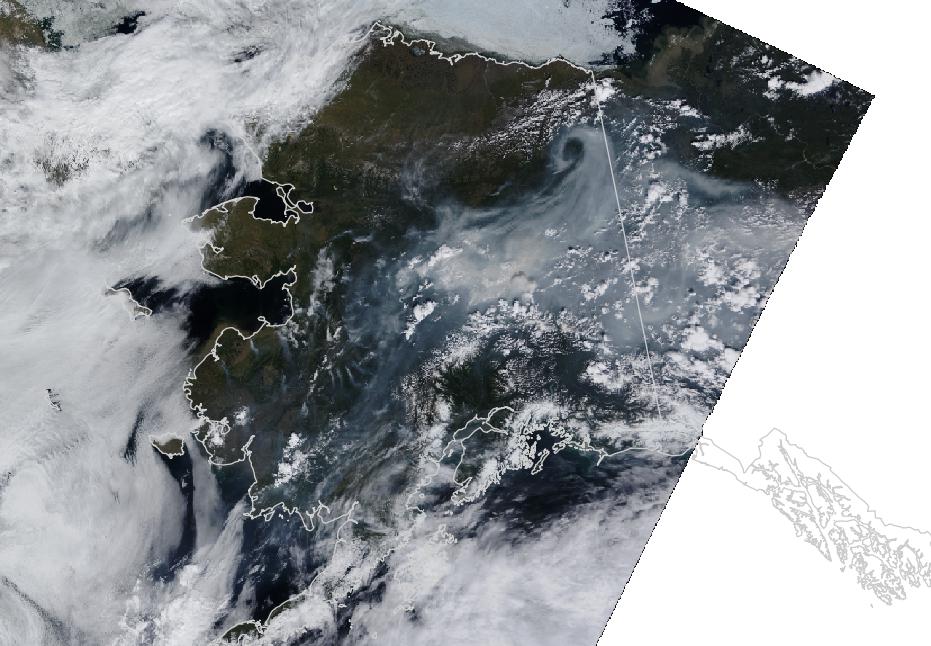
This MODIS imagery was processed at about 4 p.m. Alaska time on June 24th.
Yes, that’s a lot of smoke.
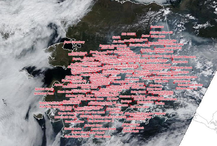
Here is a sketch of the 278 fires that managers tallied as of Wednesday evening. The number changes constantly.
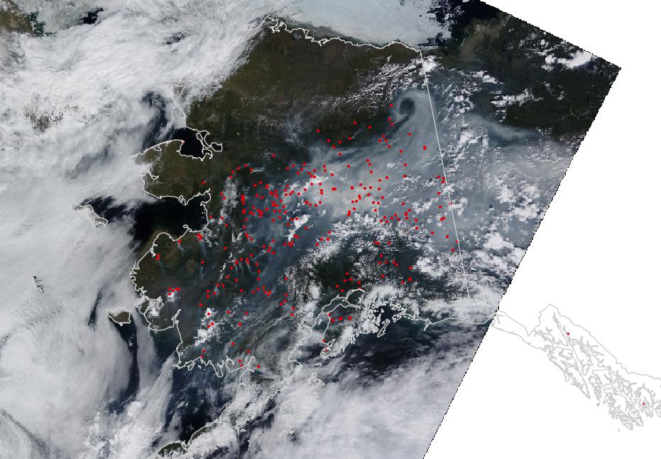
NASA’s MODIS instrument has good temporal resolution and provides valuable thermal data as well as RGB truecolor, among other data.
It gets messy trying to show the more than 400,000 acres that have burned in 545 fires this year. This image went viral for the Alaska DNR / Alaska Interagency Coordination Center.
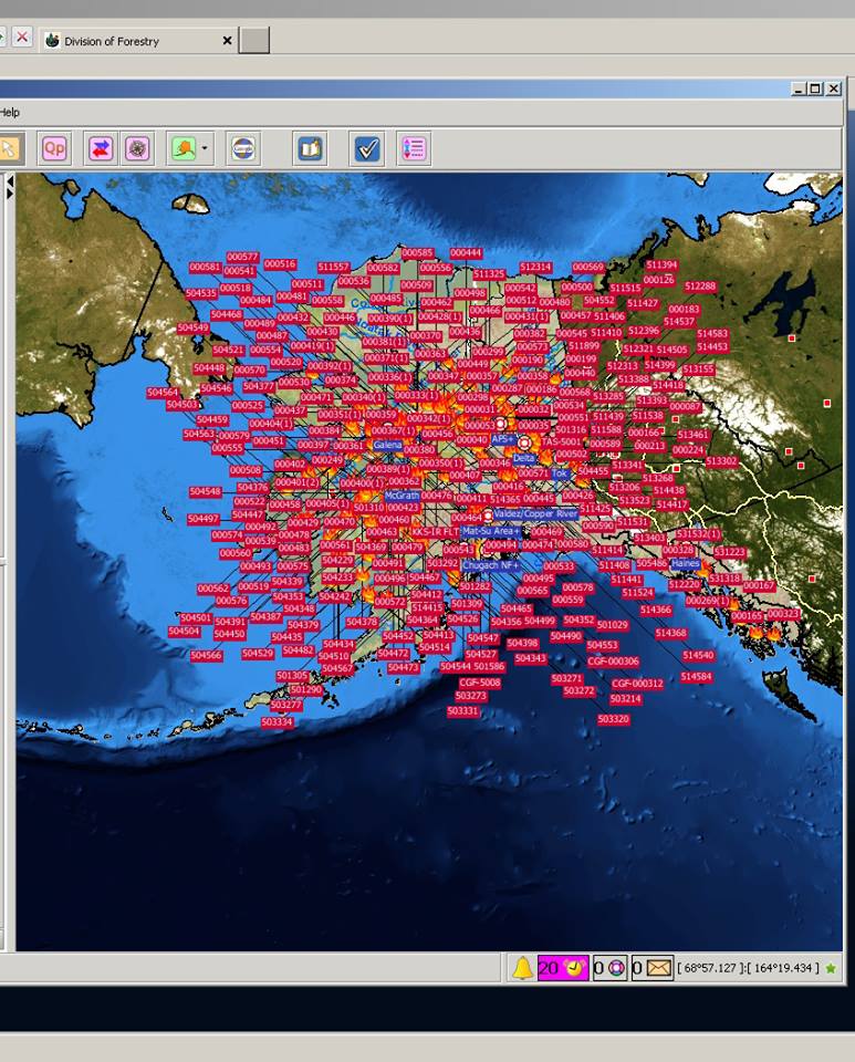
Credit: Alaska Interagency Coordination Center.
Here is my version of a tribute to that image:
That’s a little too much. I’m going to try to focus a bit on a few areas of interest to my region. 66 fires are burning in southwest Alaska.
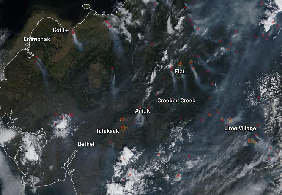
The regional hub and my home Bethel is full of smoke and in sight range of a fire northeast of town, but has largely avoided any close calls.
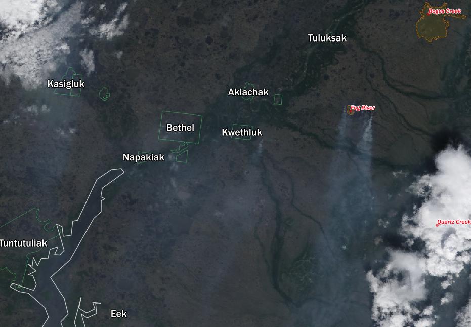
You can see the fires, however.
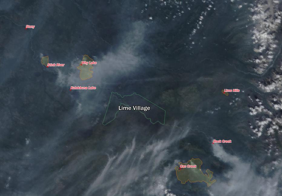
As you move up the Kuskokwim River into the hot, dry interior, things change. Aniak and Crooked Creek have fires nearby. Kalskag has seen over 40,000 acres burn (and reignite after crews left) in the Whitefish Lake and Bogus Creek fires.
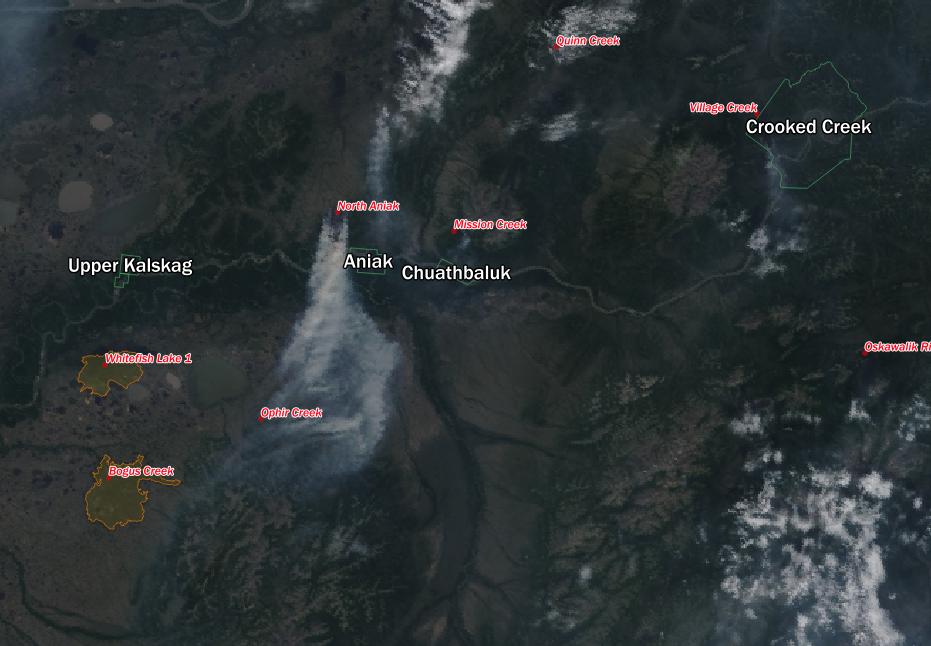
The Lime Village region also burned extensively in 2013.
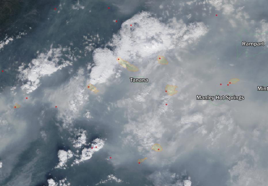
Fires intensify further east in the interior. Tanana is surrounded by fire.
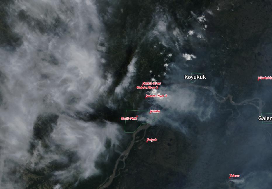
On the Yukon, Nulato evacuated by boat to Galena earlier this week.
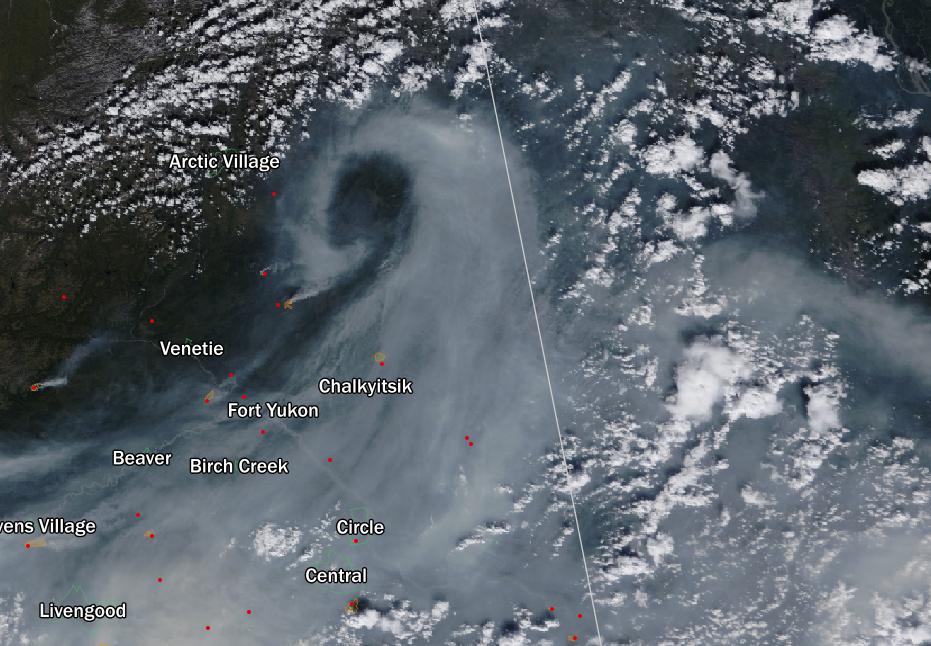
Above the Arctic Circle near the Canadian boarder, the smoke swirled.
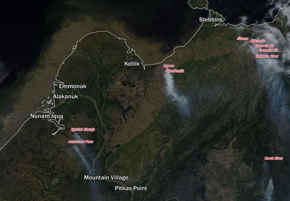
Not even the Lower Yukon got a break.
Be safe and find more information from the experts who are keeping the state safe. Huge thanks to the firefighters. They are stretched very thin.
DATA: Alaska Interagency Coordination Center, GINA, NASA, US Census Bureau. Maps compiled in QGIS 2.4.
